arXiv · 2026
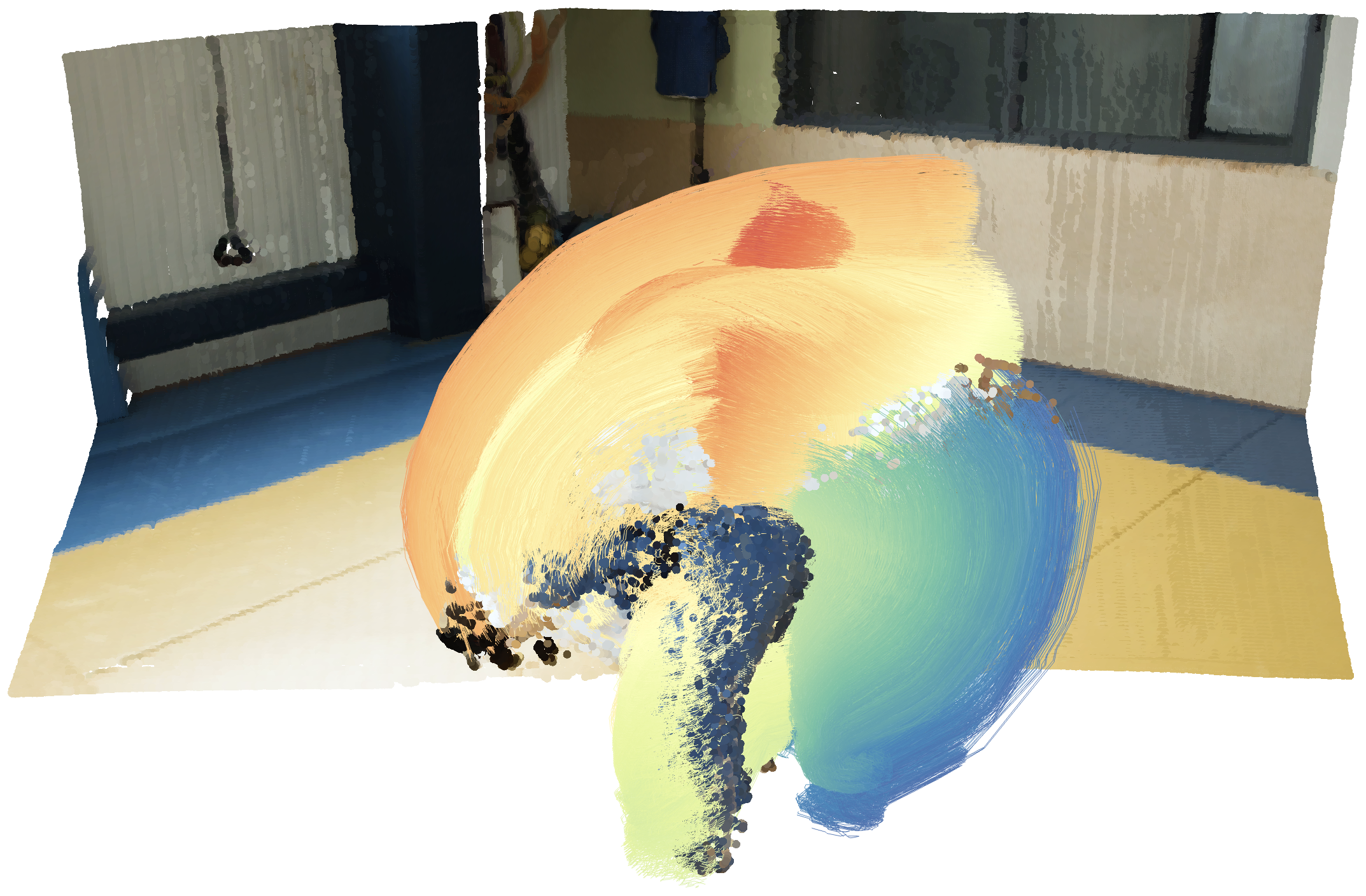
ARROW: Arbitrary Reconstruction and Tracking of 4D Observations in the Wild
Joint 3D reconstruction and point tracking from arbitrary image sets, across viewpoints and time.
PhD candidate · Computer vision
I’m currently a PhD candidate in the Computer Vision Group at RWTH Aachen University, supervised by Prof. Bastian Leibe.
My research is focused on 3D geometry estimation and 4D scene reconstruction.
arXiv · 2026
Joint 3D reconstruction and point tracking from arbitrary image sets, across viewpoints and time.
NeurIPS 2026
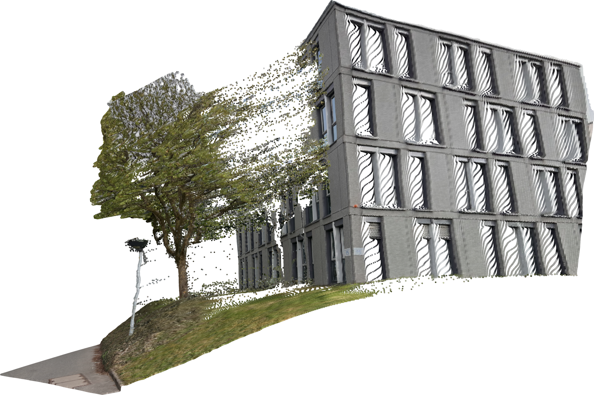
Improved local surface geometry in point maps via a Neighborhood Attention Decoder (NAD).
ICRA 2025
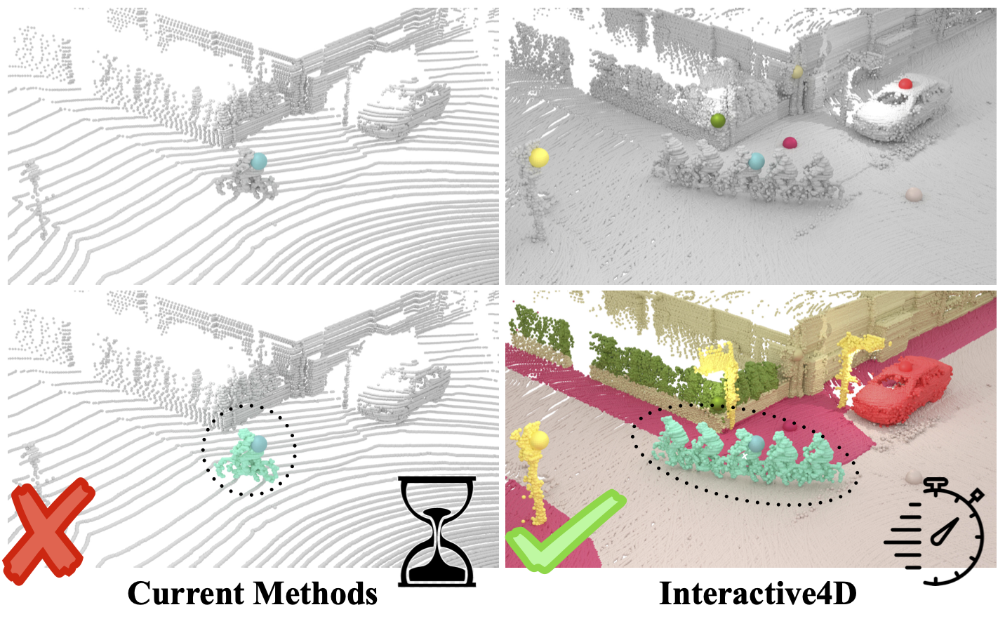
Interactive multi-object segmentation across LiDAR sequences in one step for efficient, consistent tracking and annotation.
Computer Vision Group · RWTH Aachen University
Dynamic scenes may be captured by a moving camera, multiple video streams, or images taken at different times. These observations reveal complementary aspects of scene geometry and motion, yet bringing them together requires establishing correspondence across viewpoints, capture times, and visibility changes. We introduce ARROW, a feed-forward model that unifies 3D reconstruction and 3D point tracking from arbitrary image sets. At its core is a novel order-invariant querying approach, which allows the association of queries with observations across arbitrary inputs.
We show that exposing the model to more diverse sets of inputs during training results in improved task performance. Moreover, the resulting model is capable of generalization to a wider range of tasks including multi-view tracking. Trained with this strategy, ARROW establishes a new state of the art in 3D tracking on WorldTrack and TAPVid-3D and outperforms dedicated multi-view trackers on an adapted RGB-only MVTracker benchmark, while remaining competitive across 3D reconstruction tasks.
Recent feedforward 3D reconstruction methods predict point maps and estimate global 3D geometry remarkably well. However, their predictions still exhibit inaccurate local surface geometry, which is clearly visible qualitatively but only weakly reflected in common metrics. To make these errors more explicit in evaluation, we introduce a point map normal metric that evaluates the local surface orientation induced by neighboring 3D predictions.
To reduce these errors, we propose two complementary components: a point gradient matching loss that supervises depth-normalized 3D finite differences, and a Neighborhood Attention Decoder (NAD) that progressively upsamples features and uses Neighborhood Attention for local feature mixing. Across eight zero-shot monocular geometry benchmarks, our model, SurGe, achieves the best average rank for global point map AbsRel and consistently improves local point map and point map normal evaluations.
Interactive segmentation has an important role in facilitating the annotation process of future LiDAR datasets. Existing approaches sequentially segment individual objects at each LiDAR scan, repeating the process throughout the entire sequence, which is redundant and ineffective.
In this work, we propose interactive 4D segmentation, a new paradigm that allows segmenting multiple objects on multiple LiDAR scans simultaneously, and Interactive4D, the first interactive 4D segmentation model that segments multiple objects on superimposed consecutive LiDAR scans in a single iteration by utilizing the sequential nature of LiDAR data. While performing interactive segmentation, our model leverages the entire space-time volume, leading to more efficient segmentation. Operating on the 4D volume, it directly provides consistent instance IDs over time and also simplifies tracking annotations.
Moreover, we show that click simulations are crucial for successful model training on LiDAR point clouds. To this end, we design a click simulation strategy that is better suited for the characteristics of LiDAR data. To demonstrate its accuracy and effectiveness, we evaluate Interactive4D on multiple LiDAR datasets, where Interactive4D achieves a new state-of-the-art by a large margin. We publicly release the code and models at vision.rwth-aachen.de/Interactive4D.
@inproceedings{knaebel2026surge, title = {{SurGe}: Improved Surface Geometry in Point Maps}, author = {Knaebel, Karim and Martin Garcia, Gonzalo and Schmidt, Christian and Fradlin, Ilya and Nunes, Lucas and de Geus, Daan and Leibe, Bastian}, year = 2026, booktitle = {Advances in Neural Information Processing Systems}, } @inproceedings{fradlin2025interactive4d, title = {{Interactive4D: Interactive 4D LiDAR Segmentation}}, author = {Fradlin, Ilya and Zulfikar, Idil Esen and Yilmaz, Kadir and Kontogianni, Theodora and Leibe, Bastian}, year = {2025}, booktitle = {Proceedings of the IEEE International Conference on Robotics and Automation (ICRA)}, }